Why, you might ask, would there ever be a sufficient water issue? The answer is the drought. The upstream lake levels are at historic lows. Thurmond Lake, from whence the Savannah River now issues, has a normal pool level of about 330 feet above mean sea level. Now it stands at 318 above MSL. Some people are walking around their grounded lakeside boat docks pushing lawnmowers.
The US Army Corps of Engineers tries to manage recreational water water storage demands and still let enough water go downstream from dams at the lakes to prevent saltwater intrusion into the aquifer at Savannah harbor.
Here's a link that seeks to explain how they do it.
http://water.sas.usace.army.mil/home/IndexDU.htm
The schematic on the left will lead you to river gauge readings at various locations. If you click on "Morning report" at the top of the page and scroll down to Thurmond, you will get a tabular snapshot showing levels, inflows, outflows and other data over time.
The Engineers have reduced the flow to 3800 cubic feet per second. This is worrisome because low flow contributes to channel silting. Savannah River channels have not been dredged since the 1970s. I may still bring a shovel.
However, our reconnoiter indicates there is sufficient water in the river now to float Ms. Bettencourt down to the sea. And, we had an enjoyable time finding that out.
Our first stop, on the South Carolina side of the river, was at Little Hell Landing. Some years ago the owner of a farm nearby drilled an artesian well by a slough off the main river. It is still bubbling away prodigiously. The water temperature at the fountain is about 60F. The last time Paul and I came here by boat we spotted a couple of alligators swimming across the slough. I had to be the first to wade ashore to assure Paul a gator free zone.

Little Hell is actually a fairly inviting place. The cold water from the well makes it a popular site for a shocking plunge on a hot summer day. Judging from many recently used campfire sites, it must be a destination for outings too. It is picturesque.

Continuing South from Little Hell, we drove up to a couple of lesser landings, both most notable for biting insect populations. Then, crossing the River on old US Highway 301, we visited Burton's Ferry Landing. Burton's Ferry, also known as Millhaven, is at about the halfway point on the river between Augusta and Savannah Harbor. There is plenty of water here.

The above photo is looking down river. Back in the days of river commerce, Burton's Ferry was a stopping place for tugs and barges. The bundle of pilings in the following picture is first in a row of several "camels" where towboats and barges tied up.

Highway 301 was a four-lane highway over the river here, with a high swing bridge and full-time bridge tenders. The bridge was de-activated and locked open a couple decades ago and the two lanes of the highway that once passed over the swing span have been re-routed.
The latticed pilings and swing bridge structure remain in place and seem to be as ready now as they were when the bridge was working.

Our final scouting stop of the day was also on the Georgia side of the river. Ebenezer Landing is a place with a fascinating history: The first Europeans to inhabit this area were the Salzburgers, a group of devout Protestants fleeing persecution in Austria and Germany. This building has been in continuous use as a place of worship since 1734. There was a thriving fortified community here until the Revolutionary War, when the town was destroyed by the British. The church, a large churchyard cemetery and a retreat center remain today.
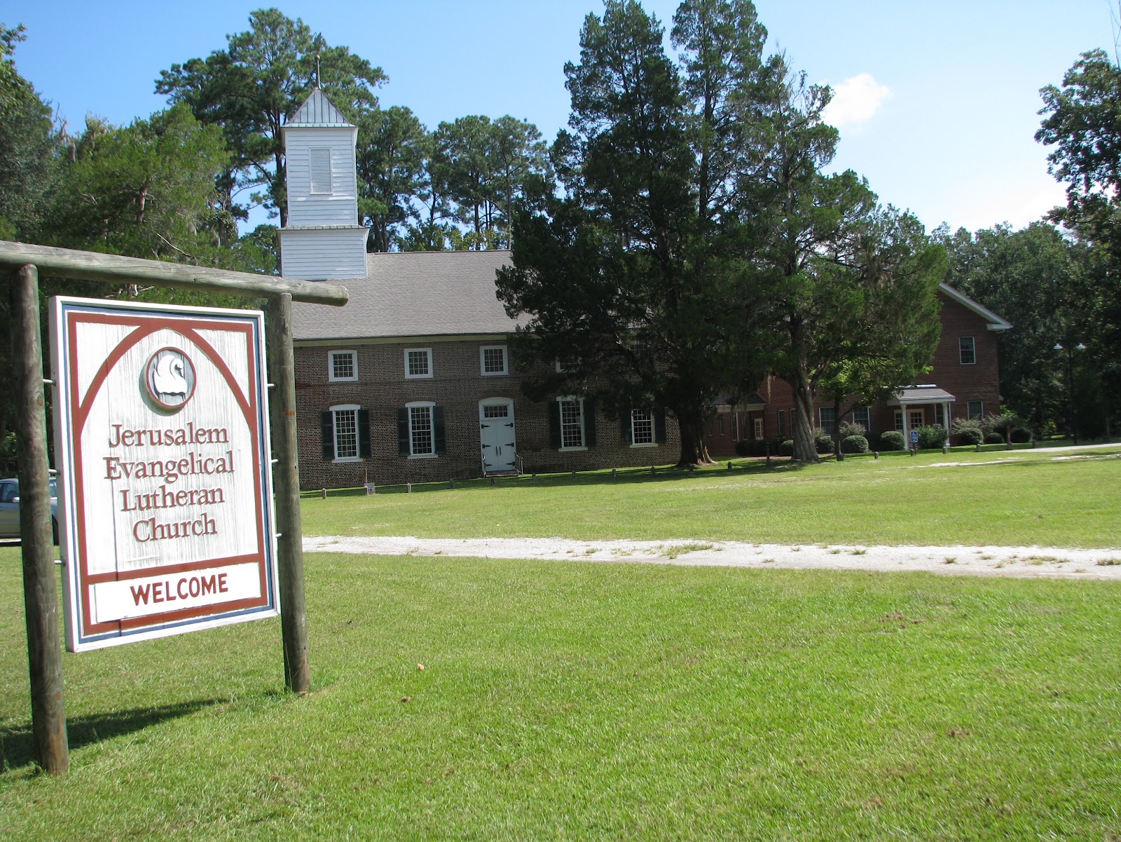
Before its destruction, Ebenezer was know for its silk production. And, briefly, the town served as capital of the Georgia colony.
We checked a privately owned. boat ramp on the river nearby, staying just long enough to confirm a healthy water flow past the place. I remember this area from my last river trip. It will be a tricky passage. The channel is mostly on the South Carolina side. Water access to the Ebenezer Landing ramp is limited to very small boats. We won't be stopping here.
Meanwhile, back in Augusta, the current plan is to launch Ms. Bettencourt into the river at the North Augusta ramp next Tuesday. We trailered her to Charleston and back last Wednesday for final modifications to the new enclosure. We are more than ready now for some time on the water.
No comments:
Post a Comment
Questions and comments are sincerely appreciated: